The remnants of a hurricane

IMAG0404

Three weeks before Bigfoot 120 (a remote point to point race from Mt. Adams to Mt. Saint Helens on 99% single track) Gwen and I trekked 75 miles on the Pacific Crest Trail from Stevens Pass to Snoqualmie Pass. We ran for 25 hours in torrential downpour, strong winds, and low temperatures. I struggled with hip pain week’s prior and by mile 35 my hip throbbed and I was in immense pain. I suffered the next 40 miles, one foot in front of the other, counted down the miles and the minutes until we finished. The adventure was both physically and mentally tough. I figured there would be no way to participate in BF 120. I spent the next 19 days resting, attended five acupuncture appointments, five massages, and two physical therapy sessions; in hopes to recover before Bigfoot 120. I hemmed and hawed for those 19 days not sure if I was going to race but planned on driving down to the race with Gwen regardless. On the drive from Seattle to Lone Fir Resort, Gwen and I chatted about my hip (she is a PT) and she gave me different scenarios and none of them sounded like I’d be doing more damage. My plan was to stop at mile 43 if it was too sore to continue; I packed a full set of dry clothes in a drop bag.

IMAG0407
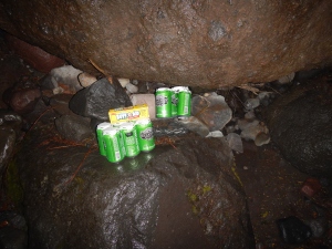
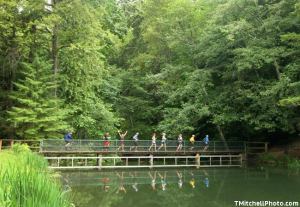
The relaxing & lazy morning at Lone Fir Resort

IMAG0414

The only good thing about a 4pm start is a very relaxing morning.

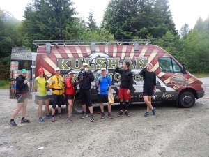
Gwen and I had a very relaxing morning, numerous cups of coffee, mouth-watering guilt free scones and breakfast…..then it was time to drive to the check-in/race briefing at Marble Mount Sno-Park and also where we’d catch the shuttle to the start. The start was located 90 minutes near Mt. Adams. Van Phan was a rock star; she was the volunteer driver and bought pizza for all the participants in her van.

The start 4pm on Friday

photo credit: Holly Thompson

The start

The start was totally uneventful; only 30 individuals started. Gwen and I stayed together for a few miles then she took off running. I was very cautious about my hip; I wanted to start off slow and steady and hike all the uphills. After a few miles into the race, I saw four or five runners (including Gwen) turn around. They haven’t seen a confidence marker in a long time (a marker on the trail that lets you know you are going the correct way). We hiked back up and took another trail but still no markers. I took out my GPS and we were off track. We turned around and ran downhill on the main trail for about 10 to 15 minutes and realized we are off course again then we saw the top three runners running back toward us. I stopped and looked at my GPS and it concurred, we were off course again. It was going to be a long race if the course continued to be vandalized! As we approached the correct turning, a handful of runners from the back of the pack placed sticks and logs at the turning in hopes the few people behind them would notice and would not continue down the wrong trail. Anxiety ran high, runners were frustrated, and our few hours in daylight had now turned to dark.

Lewis River Horse Camp – AS #1 (20.6 miles)

I arrived at the first aid station after dark. I tried to be quick so I wouldn’t cool down. As I left the aid station (an out and back) I saw Gwen as she arrived and hoped we would run together through the first night but I never saw her again. I shuffled for a while and then came to an intersection with a sign; I couldn’t tell which way the arrow was pointing. There were two trails and the sign stapled to a stump was in the middle of the two trails with a pair of running shoes and an empty Nalgene bottle. Jerks! They vandalized the course again and as a joke the vandals left a pair of sneakers and an empty water bottle. I headed up the trail and did not see any confidence markers. I ran into Matt and he stated we were going the wrong way there were no markers. We headed back down to the intersection and ran down another trail that eventually dead-ended with a big “closed” sign taped across it. Matt and I hiked back up the other trail for the second time and stopped to look at my GPS when a runner went flying past us. We were only a few feet from the intersection and the correct trail. Only hours into the race and I had been off course three times and added more miles to an already long event! Ugh!

Road 9327 – AS #2 (28.8 miles)

I arrived a few minutes behind Matt and Willie at the AS. I chatted with the volunteers, grabbed some food and headed out. After I started running again, I realized I forgot to change my headlamp batteries. A 4pm start made it difficult to keep track of time. Willie and I leaped frog a couple times on this section. It was a pretty uneventful, easy to follow, and the nighttime temperatures were pleasant as long as you kept moving.

Elk Pass – AS # 3 (43.8)

My friend, Van Phan volunteered at this AS and she made some delish hash browns and quesadillas. I changed my headlamp batteries again, grabbed a bunch of food and headed off. This would be the last aid station I would see Willie and anyone until mile 95ish. I ran the next 45 miles without seeing another 120-mile racer; I did see a handful of 100km racers whose race started on Saturday morning.

Norway Pass – AS # 4 (55 miles)

I arrived at Norway Pass and the aid station crew was spunky. They all stood up and cheered and I was a bit embarrassed with their enthusiasm – you would have thought I was winning UTMB or Western States. It gave me so much energy and made me feel so special! They were so helpful, energetic and sweet. I looked as a guy wrote down my bib number and there were only two bib numbers written down ahead of me. I was pretty stoked to be in 3rd place overall. It was early Saturday morning and I had some coffee, asked the HAM radio guys what time Gwen checked in and out of Elk Pass. It was nice to know Gwen was still on track. (After the race, I’d learn she was checking in on my status, too).

Coldwater Lake – AS #5 (73.6 miles) 

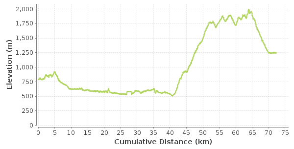
The weather started to drastically change during this section of the course. It was mid-day. It started to rain and the winds started to howl. In addition, there was a lot of overgrowth on the trail that soaked my clothes. During this section from Norway Pass to Coldwater Lake the race topped out at its highest point -Mt. Margaret. After the summit, the trail traversed for a bit then dropped down into a big bowl, I saw a herd of elk and as I got close they all scattered. Pretty cool. After a bit more rolling hills the trail dropped down to the lake and I could see that I had another mile to the AS. The aid station crew again was absolutely wonderful. They reported that Johnston Ridge aid station had been blown away.

They had an array of homemade cookies, hundreds of decorated cookies but at this stage the last thing I wanted was sugar. They gave me soup, coffee, and lots of praise. The hike out of Coldwater Lake was on pavement, the only section of pavement in the race. The storm was not in full force yet, it was torrential rain but the winds were just about to become gale force. Gwen went through this section a couple hours after me and she reported that runners turned around because the limbs on the trees were snapping off. As I climbed up Johnston Ridge, the storm really started to hit 35-45 mph winds with up to 50+mph gust. The wind was nearly blowing me off my feet then the sideways hail began pelting my face. I found a tiny bit of shelter behind a bush and changed into a Smartwool long sleeve, layered with my Outdoor Research Aria down vest then my OR Helium Jacket; I threw on my Outdoor Research Aspire rain pants over my running tights. As I continued up the ridge, the wind roared, the hail pummeled me, and each step took twice as much energy. The thought crossed my mind that they might call off the race but without lightening involved I figured they would let us continue.

Johnston Ridge – AS #6 (81.2 miles)

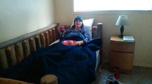
I had been dreaming about mile 81 since leaving Norway Pass. This would be my only crew for the entire race and Corinne was a total gem. I was so excited to see her. As I arrived at Johnston Ridge, the storm was in full blast (about 3pm on Saturday). I took off all my clothes and changed into dry clothes except my rain pants. I think Corrine put them in the aid station van for me to try and dry them. I crawled into her car and wrapped myself up in blankets and sleeping bags. The car was being hammered with rain and wind; I felt like we were in a car wash. I tried to sleep but was shivering like crazy. Corinne cranked the heat and I eventually fell asleep for a few minutes. I didn’t want to stay for more than an hour. Corrine was awesome; she gently woke me up and I was stoked that I actually fell asleep! This was the first time I’ve ever slept during a 100 miler but this was the first time that a 100-mile race started at 4pm requiring running through two full nights. I was so thankful for Corinne not only did she have my bag of dry clothes, she bought me a hamburger and she picked up all my gross wet clothes off the pavement.

She walked with me to check me out and I headed out into the storm wearing my Outdoor Research gear:  Aria down jacket, Aspire rain pantsRevelation Jacketbalaclavagloves  and my Smartwool long sleeve, Ibex wool bra, Northface running tights, Drymax maximum protection trail running socks, and Atlas gloves (rubber gloves Gwen bought me). I was so bundled up that after running for a few hundred feet, I had to stop to take off a layer. But, once night arrived, I used every single piece of clothing in my pack including my ER space blanket to keep warm.

Windy Pass – AS #7 (89 miles)

I arrived at Windy Pass. The AS was an expedition style tent. I sat down in the chair and searched for my extra batteries. I started to panic thinking they didn’t make it into my pack. But, I found them after a few minutes of searching and put them within easy reach knowing it was going to get dark soon and I would need them handy. I looked around the tent and saw a puddle of water and thought….omg these guys had to be freezing. The wind was howling. At least I was moving, they were stationary it must of been a very long, cold night for them. I left Windy AS and the volunteers walked with me and pointed to where I needed to go…up and over that ridge in roaring winds. Yikes. I started hiking up and luckily the ridgeline was not that far, I was up on the ridge in no time. The ridge had logs that acted like stairs; at one point I ducked down and held onto the log because the wind was howling so hard that I thought I was going to be blown off the mountain. I wanted to get up and over before dark. I hiked and hiked and darkness came. Not a soul insight, I was still in 3rd place overall even after taking an hour at the last aid station. I decided since my hip can start hurting at anytime, I would power hike and that is pretty much what I did for the rest of the race but not necessarily because of my hip but also because of darkness and technicality of the course. I was nervous going into the second night solo because of the vandalism the first night. I did not have a SPOT tracker and I forgot my PLB (Personal Locator Beacon) at home. The race was super remote and the aid stations were miles and miles apart and hours and hours from one another.

Windy Pass - holding the tent

Windy Pass – photo by Holly Thompson

After I descended down from Windy Pass I made a big navigational error. I couldn’t find the markers. I had been going for 92 miles and racing for over 24 hours I was tired. I arrived at Plains of Abraham at dark. I did not see the markers and ended up hiking deep into the gully. I couldn’t see a trail; I was tripping over volcanic rock. I took out my GPS and yep –I was way off course. I turned around and found the last known marker and tried again. This time I saw one in the distance. I came to the marker and didn’t see another one. I decided that this is where I needed to scramble (at the briefing they talked about picking your way through part of the course, I thought this was the section…NOPE!). I ended up traversing on a pumice slope, the wrong way. I traversed and realized there is nothing to hold on to and I was slipping. I looked down and one wrong move I’d tumble down into a bed of volcanic rocks. It was dark, I was tired, and I had been awake for over 36 hours. I tried not to panic but I was – besides aid station crew and a few 100km runners I had not seen anyone in a very, very long time. I very cautiously traversed off the pumice slope and then back to the last known marker and started again. My adrenaline was off the hook. I was wide awake and cursing myself for not paying more attention.

I found the last known marker and I started to descend the pumice slopes, crossed a river, crawled up a bank because the trail was washed out and continued on. I saw a headlamp in the distance! Seriously, there was someone else out here! Awesome. I tried to speed up to catch the runner and when I did I was stoked. He was moving pretty slowly, I passed him and then turned around and asked if he was okay and did he need anything. He replied he was fine but his feet hurt. Then…he passed me and we leaped frog through the river crossings until it was natural for us to stick together. He needed to stop and eat and I was thankful because I needed to change my batteries in my headlamp but didn’t want to stop because I had been racing solo this whole time and it was nice to finally see someone. He ate, I changed my batteries and we continued. A few hundred feet later, I slipped off the trail awkwardly into some bushes and he (Phil) came back to help me. After hiking for a few miles we heard a voice. We were both tired and I was cranky (we didn’t talk much because my ears were covered by my wool hat plus two hoods and with the wind howling and the rain violent we couldn’t hear each other). But, in the distance we heard a guy hollering at us. We couldn’t make out what he was saying. We thought he was saying we were off course but he was yelling that he was off course. He said (I think) he was about to push SOS on his SPOT because he couldn’t find the trail. He joined us and we all made our way down to the Toutle river crossing.The trail was completely washed but there was a fixed rope to help us get down the vertical bank to the river. Once we were all down, we walked up and down the river trying to find a safe spot to cross; in the middle of the night. We finally found a spot we felt safe and the two guys went first then I followed. I was almost across and slipped on a rock and my right leg plunged into river. After making it to the bank we could not find the fixed rope to climb out of the ravine. We finally found it and later learned the river had swelled so much that it washed away all the markers. We climbed up the rope and continued on without saying a word. We were all too tired to talk plus with the wind we had our heads buried and were in death-march mode. At one point, we stopped to look at my GPS to make sure we were on track. I was grateful to have run into Phil and thankful he led the rest of the way to Blue Lake Aid Station. I felt if I did not see him and Ray, I would have crawled through that section with the tricky navigation and tons of river crossings. We finally reached Blue Lake Aid Station.

In a perfect world, we would have seen this view instead of the one above

windy pass bigfoot

But, instead….this was the view

Bigfoot 120

Blue Lake – AS #8 (108.1 miles)

Awww…I was so happy to see the AS volunteers. I cannot express my gratitude enough, light-hearted, helpful, and funny. I took off my down jacket and my raincoat and wrapped my space blanket around my torso. Opened more packages of hand warms and put two in my bra and two in my right glove. I lost my right orange rubber glove while scrambling (I told Corinne at the finish line that I bet Gwen found it on the course & she did!) They encouraged me to sit down in front of the heater and warm up before heading off. I ended up staying and bullshitting with the guys at the aid station for 25 minutes. It was a highlight. They tried to fix my trekking poles for me, they were both broken, and they helped me clear out all the soaking wet half eaten food from my pack (gross). I was sleep drunk at this stage and the crew was cracking me up; they were hilarious. Phil and the Ray planned to stay longer at the aid station so I said good-bye at 2:05am and headed out – only 12 miles to go!! But, those 12 miles took me five hours! The last section was the much talked about lava fields that required boulder hopping, in the dark, while holding onto one trekking pole that would not fold (PITA) all while trying to locate the markers. On a positive note it had stopped raining and the sky was crystal clear and sparkled with stars. The stars started to look like course markers as I picked my way through the lava beds. I leaned against a tree and spent some time stargazing and dreamt about watching the sunrise.

I trekked along, going up and over enormous volcanic boulders and finally the boulders started to peter out into a trail. I was relieved to be off the lava bed but a few strides later another lava field! After volcanic rock hopping for nearly a mile I looked forward to running the rest of the way to the finish only to find the trail was off camber, rutted out single track. My Suunto Ambit watch died I had no idea how much farther. I was hallucinating at this stage – I saw a camper van covered with elk horns, a random guy sitting in a lawn chair and other random vehicles that did not exist. Then finally I saw the big blue blown up arch and knew that I was finished! It was Sunday morning around 7am; it took me 39 hours! (The race started Friday at 4pm).

Corinne was one of the very few people at the finish line to greet me; so awesome and so unexpected. No one else was up, I think Van Phan might have greeted me, too. I don’t remember. Garrett one of the RD’s gave me a high five (I think) and wrote down my bib number. The finish line was empty, uneventful, and quiet. Only a handful of people sauntered around. I sat for an hour with a blank stare; a wool blanket wrapped around me and ate pizza. I finally motivated myself to walk to my car and change my clothes. I did not want to sleep because I wanted to see Gwen finish but we were able to radio the last aid station and figured out roughly what time she’d finish. I took a snooze in my car then rallied back to the finish line to see Gwen finish!

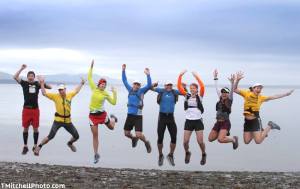
Finish – Marble Mount Sno-Park (120 miles)

20151011_151421

An epic weekend. The point to point single track trail was absolutely amazing; it had a lot to offer: steep technical sections, pumice fields, river crossing, washed out trails, lava beds, and sweet single track. It was a pity Washington State was hit with the remnants of hurricane Oho. The pictures the race director loaded to her FB page prior to the race were stunning.

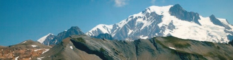
The next day, Windy Pass volunteers caught a glimpse of Mt. St. Helens that they didn’t even know what right in front of them; absolutely stunning. (See pic above).  All the hard work and endless organization that went into this remote single-track race, it was a pity the weather ruined it for the majority of the runners. 30 runners toed the line and 7 finished.

The 100km started on Saturday morning running 68 miles of the same course and 41 runners toed the line and only 13 finished.

Leave a comment

Filed under Event

Vancouver 100km Baden Powell Trail

Vancouver 100km Start

Vancouver (BC) 100km “Fat Ass” is an epic out and back trail run on the Baden Powell Trail. I had no idea how hard it was going to be even though it claims to be the “toughest 100km around!” This run does not disappoint. If you are from the PNW and you are training for TdG or  UTMB this is where you will want to spend your training days.

I asked my friend, Jackie, to run it with me since she has completed it three or four times. She wasn’t too stoked but she rocks and did it with me anyhow!  As mentioned above, this run is a “Fat Ass” run meaning there are no course markings, no aid stations, no whining, no prizes, and no official timing. Therefore, you either run with a map which takes twice as long or you find someone who knows the route. Besides navigation you have to have really good friends or an awesome husband to dedicate their Saturday to support you and luckily we had both. Chloe is amazing, she was crewing others but was happy to help crew us, too. Dave also crewed and met us at a couple spots. There are some water spots along the route but because it takes 16 to 18 hours to run the 100km it is super helpful to have someone met you with water and food. It would be tough to do this run self-supported. (Doable, but tough and preferably without temps in the 80’s to 90’s).

The trail is hard to describe if you have never been to the North Shore. The trail traverses the Greater Vancouver’s North Shore region. It offers everything from gnarly roots to a plethora of wooden stairs to steep ascents/descents and a mass boulder field. My Suunto Ambit clocked in 18,247 vertical gain and 61.9 miles. I think the vertical gain on my watch was a bit exaggerated; I’m told the route is roughly 16k+ vertical gain. Regardless, there is a ton of climbing which results in a lot of hiking. The trails are so technical making it extra challenging to navigate at night. I dream of having trails like that in Seattle. The only thing that comes close is Teneriffe (the front steep side) and the old Mailbox trail.  I’m jealous my Vancouver friends have these bad ass trails to train on year round.

Eagle Bluffs

Eagle Bluffs

Jackie and I finished in 18 hours and 37 minutes

Finished!

Leave a comment

Filed under Uncategorized

The Best of 2015

Hannegan Pass, Aasgard Pass to Snow Lake, Devil’s Dome & Northern Loop Mt. Rainier.

Hannegan Pass / Cooper Ridge

September 12th, 2015.

27 miles / 9k vertical gain / 7 hours

Located in the North Cascades Mt. Baker area

We did an out and back versus a loop because the weather was so stunning we wanted to stay high.

20150912_100052

Mt. Baker, Mt. Ruth and Mt. Shuskan – a view from Hannegan Peak. North Cascades.

At the summit, the views are endless! 360 degree views of Cascade peaks, including Goat Mountain, the High Divide, and the Nooksack Ridge to the west. To the north are the peaks of British Columbia and the Silesia Creek valley, and to the east, Copper Ridge and Mount Redoubt in the distance. However, the most impressive are with in-your-face vistas of Mount Baker, Ruth Mountain, and Mount Shuksan, the East Nooksack Glacier and the Nooksack Tower.

20150912_100139

20150912_095358

A view from Hannegan pass looking east.

20150912_095854

Aasgard Pass to Snow Lake 

July 11th, 2015

20 miles / 5k gain / 7 hours

Located outside of Leavenworth, Washington.

20150711_120602

20150711_115016

Guaranteed to spot a sheep

zoWhFlf9rA3-WlnAZ6YWmGel6F6-LNkUSXl4mdJSj7w

11737974_10205597154822390_1886734286993459946_n


20150711_121204

Devil’s Dome Loop

8/01/2015

44 miles with 12k vertical gain and about 14 hours.

Located off Hwy 20 – North Cascades Highway

20150801_071459

We did the loop counterclockwise.

20150801_101145

20150801_103227

Scree field

20150801_102048 20150801_143731

Northern Loop @ Mt. Rainier

July 10th, 2015

We started the hike at Sunrise Parking Lot.

20150710_09110636 miles and a bit over 10k vertical gain
20150710_094051

It took us roughly 11 hours

20150710_100121

We met a Ranger working hard. His job is to take out old toilets and replace them with new ones.

20150710_080018

George and Van crossing the river

20150710_162510

The meadows were breathtaking

Although it was a tad cloudy, it was still a beautiful day on the trails. 

20150710_153430

Leave a comment

Filed under Uncategorized

Focus on the Moment – Tor des Geants 2014

Tor des Geants 2014 738 Starters

Dave and I at the start. He cheered me on at the start and then headed over to Switzerland to bike for five days. He surprised me on the trail late Thursday night/early Friday morning.

738 athletes from 60 countries toed the line for the fifth annual Tor des Geants trail race. The Tor is a single stage, 330km, trail run on the “Alte Vie trails” 1 and 2. It is a counterclockwise loop starting and ending in Courmayeur. Courmayeur is located in the Aosta Valley, Italy’s smallest region. It is surrounded by Europe’s tallest peaks (the four giants of the Alps): the Matterhorn, Monte Rosa, Gran Paradiso, and Mont Blanc.  The trail takes you over 25 mountain passes totaling 78,000 feet of vertical gain. This single stage race must be completed in 150 hours and due to the massive elevation gain/loss, sleep deprivation, and mental fatigue the dropout rate is 40% to 45%.

There are 7 life bases: Valgrisenche, Cogne, Donnas, Gressoney, Valtournenche, Ollomont and Courmayeur. At each life base a pin (see pic below) is awarded to the runner. The life bases are usually sport complex centers – big gyms with cots spread throughout the gymnasium or wherever there is open space, an array of food (pasta, soup, bread, crackers), medical staff, and lots of volunteers. You are allowed to recover and sleep as long as you want at a life base but at all other aid stations or mountain huts (Rifugios) you are only allowed to sleep two hours.

Col. Crosatie -9,281feet

Col Crosatie -9,281 feet

Start – Sunday @ 10:00am

The locals of Valle d’Aosta are genuine, kind and beautiful people; they know how to host a major sporting event. Hundreds of locals and spectators lined the cobblestone streets through the town of Courmayeur (and all the villages along the route) rang cowbells, cheered, and offered high fives. The first 20 miles were breathtaking and steep but uneventful until running down the backside of Col Crosatie. Out of nowhere, overlooking a beautiful mountain lake, there stood a massive stone memorial for Yuan Yang. It stopped me in my tracks. It was beautiful and heartbreaking. Yuan Yang died in last year’s race (2013) when he slipped on a rock and hit his head. I stood there looking at the memorial and looked at the stunning terrain that surrounded it. I thought about his family and friends and as cliché as it may sound, I had a feeling he was doing what he loved in a very beautiful part of the world. My mantra going into the race: Focus on the moment – Live/Be in the Moment -and seeing his memorial reinforced my desire to enjoy each minute of this journey.

Valgrisenche - The first Life Base. 30.6 miles and 13,500 vertical gain

Valgrisenche – The 1st Life Base. Section stats: 30.6 miles and 13,500 vertical gain.

The first life base: Valgrisenche (30.6 miles) – Sunday

I arrived at the first life base at 9:55pm; just under twelve hours. I went out very slow, in retrospect probably too slow. I had a goal. I wanted to finish in 120 hours. I followed a racer whose bib number was #90 meaning he finished in 90th place last year. I stayed behind him for the majority of the day. He was slogging. He was going so slow but I figured he knew what he was doing! I kept repeating to myself, ‘patience’ because the theme of The Tor is straight the ‘effing up and straight the ‘effing down, hours and hours of steep rocky ascents (one peak is a stair step to the next peak) and hours and hours of steep gnarly descents, then repeat day after day for 332 km (206 miles) on very little sleep.

I devoured some food and headed out solo into the night. I missed the turn onto the singletrack trail and luckily another racer behind me shouted.  I was so grateful; this was my second time missing a turn and both incidences a racer in the distance shouted at me. The course is marked incredibly well, the two turns I missed were because it was dark and I was looking at the ground versus paying attention.

I leapfrogged other racers throughout the night and when I arrived at Rhemes at 2:44am; I decided to have my first two-hour sleep. I slept pretty solidly then woke up just shy of the two hours and continued on throughout the night- ascend, ascend, ascend…descend, descend, descend…. I got into a rhythm and enjoyed the solitude.

Helicopter in for shelter and water

An aid station flown in via helicopter.

Col Loson 10,823

Col Loson 10,823 feet

Cogne 34 miles & 13,600 vertical gain.

Cogne: 2nd Life Base – Section stats: 34 miles & 13,600 vertical gain.

The second life base: Cogne (63.44 miles) – Monday 3:47pm

I arrived at Cogne and had a quick 30 minute transition. As I departed, I met Valerie, a strong, fast, mid-50’s, French badass. I only mention her age because I hope I’m as strong and just as much a badass in ten years. I was struggling to keep up with her. She had completed numerous races all over the world.  We ran together to Rifugio Sogno di Berdze and planned to sleep there for two hours. We arrived at the Rifugio around midnight. Valerie ordered a delicious plate of polenta and we shared it (some mountain huts offered food for purchase). We attempted to sleep for two hours but there was a generator right outside the door and it was roaring loud. I slept on the top bunk next to the door and every time the door opened, the cold air and generator woke me up. (Looking back, I should of made an effort and moved to an empty bed in the back of the room.) Valerie didn’t have her bib number visible on the bed (the rules are to display your bib number so the volunteers know who to wake up because there is a two-hour maximum sleep rule at the Rifugios). Valerie was woken up early by mistake and headed out. I continued to sleep but was freezing. I headed out about 30 minutes after Valerie.

I spent most of the evening solo. As I hiked up a to 9,000 feet at 2 a.m. from Rifugio Songno di Berdze to Fenetre di Champorhcer, there was an amazing lightning storm in the distance that went on for hours. It was spectacular. As I dropped down into the valley headed toward Chardonney, there was a section which was pretty technical in the wet and dark. I stopped and put one headlamp around my waist and one on my head in hopes of picking up my pace. I arrived at the aid station and the weather turned for the worse — a torrential downpour. Martha and Bruce were at the aid station hanging out. I met Bruce a couple of months before The Tor when we attempted a 100 mile run from Bellingham Bay to the summit of Mt. Baker. I chatted with Bruce and his wife Martha and we contemplated sleeping in the lounge chairs in the corner instead of heading out in the torrential rain but then we thought twice about trying to sleep in an open tent that was loud and cold. It’d be a waste of time. We put on our rain gear and headed out….luckily the rain didn’t last long. I spent the rest of the night running with Martha, Bruce and a guy from Belgium.

Just outside of Cogne

Just outside of Cogne

Tdg (17)

Another beautiful summit

Donnas - The 3rd Life Base. 29 miles 11k gain

Donnas – The 3rd Life Base. Section stats: 29 miles 11k gain.

The third life base: Donnas (92.39 miles) – Tuesday 7:35am

A couple of miles shy of Donnas, I ran into Gretel, a badass lady from Australia. Prior to the race, I had met her in Courmayeur and we stayed at the same hotel — Hotel Croux — which is the most friendly  hotel in all of Courmayeur. We chatted and shared stories and then went our separate ways once we arrived at the life base. I spent three hours and forty-five minutes at this life base and I have no clue what the hell I did for that long. This was the first time I wished I had a crew. I wished I had real food to eat, I wished I had someone to help reorganize my drop bag because it was a mess, someone to help re-tape my feet and someone to monitor the time I spent at the life base. I was definitely starting to feel fatigued because the little tasks started to feel like a lot of work. I spent twenty minutes just staring at my feet in the bathroom. I finally changed my clothes, brushed my teeth, washed my face, re-taped my feet, ate some food (mainly soup), and slept for 40 minutes. It was hot and noisy, making it near impossible to sleep but I did fall asleep because I woke myself up with a huge body spasm. I left Donnas at 10:11 am (11 minutes behind my pacing chart, my goal of 120 hours) and shortly afterwards I ran into Graham (Anacortes, WA) who I emailed back and forth for months prior to the Tor and who I’d met the night before the Tor. It was rejuvenating to hike with him and we took a few pictures before he went on his way. He attempted The Tor last year but did not finish; this year he was determined to finish ( And, he did! 126:51 ) but his main goal was to truly enjoy himself.  I took 130 pictures and I bet he took close to 1,000. He literally stopped to smell the roses and took pictures of all the flowers along the never-ending climb up and out of Donnas. His enthusiasm was contagious.

Etoile du Berger - Aid station

Etoile du Berger – Aid station

col

never-ending beauty

Gressoney - The 4th Life Base. It poured down rain all night and the trail was a muddy mess. 32 miles and 15,000 Vertical Gain

Gressoney – The 4th Life Base. Section stats: 32 miles and 15,000 vertical gain.

The fourth life base: Gressoney (124.5 miles) -Wed 7:22am

Donnas to Gressoney was the most difficult part of the course: 32 miles and 15k vertical gain in the dark and in nasty weather. It was wet, muddy, slippery, slimy, and a nightmare. I would take two or three steps and fall on my arse. I was having PTSD flash backs of my Adventure Racing days, slogging for hours on end, and not making much progress. I was so frustrated. My base layers were already wet by the time I stopped to put on my Outdoor Research rain gear. Regardless of wet layers my OR rain gear kept me warm while I was moving.

I was running with Jackie at this point. I met Jackie the same weekend I met Bruce, attempting the Mt. Baker run.  We decided to sleep at Niel. There were no beds available so we had to sleep in the two huge tents outside that the race organization had set up. There were two cots available, one in each tent. At 6,000 feet it was effing cold outside and I was freezing. I took off all my wet clothes, which was pretty much everything, wrapped a wool blanket around my body and slept on a cot that had cold air blowing up from the ground. I was shivering uncontrollably. But, I thought, if this was an adventure race, I’d be sleeping on the ground in a bivy sack. So suck it up.  I slept for (I think) 1 ½ hours. I put back on my wet, soggy, muddy clothes and went to the other tent to wake Jackie up.  She wanted another half hour of sleep and I agreed. I went back into the tent, took off my wet shoes and clothes again, and tried to sleep for an additional half hour; a total waste of time.

We left Niel around 3am for another long steep ascent to the summit. We were almost at the summit of Col Lasoney when we heard and then saw a woman lying on the ground on her back. It was Valerie! Valerie was having heart issues and she asked us to raise her feet in the air. I grabbed her feet or Jackie grabbed her feet (one of us did) and she told us to hold her feet for twenty seconds then lower them. We did this twice. It wasn’t working. She was on her phone, talking to her husband (I was shocked she had cell service) and he told her to take her medication. She told us she’d be fine and to continue on with our race. I did not want to leave her; I offered to stay with her. She was adamant and convinced us she was totally fine, it wasn’t a big deal.  She insisted that we continue. She said it had happened before, she would take her medication and wait a few minutes and then she would be recovered. I was not comfortable leaving her on top of the mountain pass. I looked backed at her; she saw me look back and shouted…. ‘Go, I’ll be fine.’ I ran with Valerie for seven hours earlier in the race and I knew this was her third Tor and that she was a very experienced ultra runner (she had travelled around the world racing) and she had a PhD in Pharmaceutical Science. With a knot in my stomach, I took her advice, and continued on. I saw her at the finish line and she had to be evacuated by helicopter off the mountain. It brought me to tears when she told me she had to be evacuated. I can justify the hell out of it and say she convinced me she was okay, she was adamant and/or I wasn’t thinking straight, I’ve been racing for 58 hours on less than five hours of sleep – but there is no justification – it wasn’t right! I should have stayed with her until help arrived.

full moon

I loved seeing the moon every morning, this is at sunrise! Absolutely stunning.

Rifugio Alpenzu

Rifugio Alpenzu

Valtourneche - The 5th Life Base. 24 miles and 8,500 vertical gain.

Valtourneche – The 5th Life Base. Section stats: 24 miles and 8,500 vertical gain.

The fifth life base: Valtournenche (146.83 miles) -Wed 7:54pm

When I arrived at Valtournenche, Jackie and I realized our drop bags  had not arrived and it was our fault. (The race organizations hands out a duffel bag “drop bag” to each racer, you are only allowed to use this bag; they transport the bag to each life base). Back at Gressoney, the last life base, we didn’t leave our bags in the proper spot. When you check out of each life base, you drop your bag next to the checkout. Sleep deprivation and fatigue caused this screw up. We found a volunteer who spoke English and he did some research to see if our bags would be delivered before we headed out to the next life base. The volunteer said they’d be there by midnight (it was only 8pm).  While we waited for our bags, I slept for two and half hours. Besides my down jacket, I had to sleep naked because all my clothes were wet but I was happy that I was not at 6,000 feet freezing my arse off in a tent. I was in a warm gym, on a cot, with a wool blanket. After waking up, we finally found out the bags were transported to Ollomont, the next life base. Beside dry clothes and other necessities, my spare food was in my drop bag so I had to fill up a plastic zip lock with food from the table – potatoes and bread. Jackie had to borrow batteries and then we finally headed out after midnight.

From Valtournenche to Ollomont was a slog. I started to hallucinate.  My favorite hallucination was a panda bear standing on the trail wearing a red stripe tie. I was stoked to see the panda bear and wanted to see him again. My other hallucinations throughout the Tor included rocks that turned into families huddled together in fetal positions, tree trunks turned into people, cars, or huts and a little girl standing alone on a hillside cheering for me (my favorite).  She was a cute little girl and I thought it was so sweet she was cheering for me but then I thought ‘what is she doing out in the middle of nowhere by herself?’ By the time I reached the hillside, she was gone!

Panda bear

This panda bear needs a red stripe tie.

Tdg (131)

One of my favorite memories of the race.

Col Champillon

This guy was awesome. We shared a bunch of dried sausages and he had a glass of wine. I wanted a glass of wine but thought twice. I’d probably fall on my face and pass out for days because I was so tired.

Tdg (122)

Ollomont - Life Base # 6. 29 miles & 8,900 vertical gain.

Ollomont – Life Base # 6.
Section stats: 29 miles & 8,900 vertical gain.

The sixth life base: Ollomont (176.1 miles) Thursday 5:18pm

Jackie was having intestinal problems at this point in the race. We hung out at Ollomont for an additional 45 minutes, figuring out if she wanted to continue. She text messaged a friend back home (Canada) who she trusted and asked his opinion. She decided to continue and she struggled up Col Champillon. We stopped at the first Rifugio on the way up to Col Champillon to eat more food (broth with orzo) hoping that she would recover. However, she didn’t. We finally summited Col Champillon and then faced a dark, gnarly, steep, overgrown downhill into Pollimont. We arrived around 1am.

Seeing Dave for the first time since the start of the race. Mile 181. It was a huge surprise.

Seeing Dave for the first time! Mile 181.

As I neared the Ponteille aid station, I saw Dave. I was totally surprised and so happy. He had been waiting there for two hours eating and drinking nettle whiskey (or something like that) with the aid station crew. The mountain hut crew stated only nine or ten women had been through the aid station. Dave was biking in Switzerland for the past five days while I raced. I knew I’d see him at some point along the course but I had no idea I’d see him at Ponteille. I was beyond excited. Dave and I chatted as we waited for Jackie to eat more food, in hopes it was going to make her feel better, but nothing was working. She was still experiencing intestinal problems.  Dave offered to walk with Jackie to St. Rhemy’s, the next aid station that offered medical assistance. I took Dave up on his offer and sadly said good-bye to Jackie.  I ran most of the way down to St. Rhemy but then the sleep monsters hit big time a few miles before the aid station. I was so tired; I was swerving all over the road.  I arrived at St. Rhemy, the only racer at the aid station tent. I put on my down jacket, ski mittens, and started shoveling pasta into my mouth while I tried to sleep. The aid station volunteer kept swatting me, shaking his finger at me, and telling me ‘no’ in Italian that I’m not allowed to sleep at the table. He did this three or four times, it became a joke. But I couldn’t keep my eyes open; I thought please let me eat a spoonful of pasta, sleep for a couple of minutes then eat another spoonful….but no — he kept swatting me.  I finally finished my pasta which felt like forever and then Jackie and Dave arrived. At this point, Jackie was sick and the medical staff strongly advised, if not insisted, that she drop from the race. After running 300km (186.5 miles) she dropped and the next day was admitted to the hospital for a few hours for blood test and IVs.

Beautiful sunrise. Heading up to Col Malatra - 9,632

Beautiful sunrise. Heading up to Col Malatra – 9,632 feet.

Almost to the summit

Almost to the summit

After chatting with Jackie and wishing her well, I decided to take a 20 minute nap to fend off the sleep monsters. I had 18 miles left including one steep technical climb. Dave decided to wait for me and then hike with me (he was still in his mountain biking shoes) to the summit, the last summit of the race: Col Malatra. We hiked in the dark for a few hours and gradually a beautiful sunrise appeared on our ascent up to 9,632 feet. I had been waiting for this moment, I talked to a handful of Tor finishers prior to the race, and they all said the same thing – just get to Col Malatra! And, when you get there, stand at the summit and savor the moment because your journey is coming to a close. So, I did. I stood there looking around at the beautiful terrain then I looked down.

Col Malatra 9,632

Col Malatra

Now....down, down, and more down.

Now….down, down and more down.

Looking back up, you can see a racer at the summit.

Looking up….. you can see a racer at the summit.

And, more down....almost there.

And, more down….almost there.

Holy crap, I have to descend THAT! I descended the steep rocky scree trail for miles (which felt like days) until I reached Rifugio Bonatti, the second to last aid station and about two and half hours to the finish. I was so impatient. I wanted to be done. I was still running or shuffling the flats and downhills but even the slightest incline in the trail brought me to a crawl and almost to tears. This was my lowest moment in the race. I was struggling to hold back the tears. If Dave wasn’t with me, I would have sat on a rock and cried. I didn’t realize it would take this long to get to the finish. I did not want to see one more uphill or one more downhill and definitely no more rocks. I had climbed 78,000 vertical feet and descended probably the same on loose crappy steep gnarly trails. After reaching Bertone, the very last aid station, I still had 45 minutes to the finish. I felt like this death march was never going to end. After 332.3km (206 miles), 122 hours and only 10 hours of sleep I finally reached Courmayeur and the red carpet I had dreamt about for eight months.

The FINISH! 206 miles and 78,000 feet. 11th - Female 142 / 738 overall

11th place (F) 122 hours and 7 minutes. 
                             2nd place age group and 1st (F) American                        99 women started and 44 finished.

Holy Crap! That.was.hard!

Courmayeur - The Finish and last Life Base.

Courmayeur – The finish and last Life Base – Section stats: 30 miles and 9,500 gain. Total: 206 miles and 78,000 vertical gain.

The 2014 Tor results:  Results

Leave a comment

October 6, 2014 · 5:43 pm

Bellingham Bay to Mt. Baker

Bellingham Bay to the summit of Mt. Baker

10502420_10152479255188953_568600705928329489_n

Aaron, Bruce, Susan, Dan, Beat, Jackie, Deb and Emily

TMitchellPhoto.com

10426647_10152479255463953_7461407330361033196_nThe start: June 27, 2014 Cornwall Beach Park -Bellingham Bay

10435837_10152479255133953_675649413299708909_nDan invited me to join his 108 mile out and back “fun” run from Bellingham bay (sea level) to the summit of Mt. Baker. Mt Baker stands at 10,781 feet and is  volcanic, glacial peak.  Dan’s goal for this ‘fun’ (40+ hour) run was a recon mission for a future race he is determined to make happen. His goal is to recreate/create the Mount Baker ultramarathon; his ideas and passion for this new race is stemmed from the story of the first Mount Baker Marathon in 1911, his love for the North Cascades and his experience racing TdG –  Tor des Geants.

I was pretty stoked to participate but I was also nervous about the impact of running 60 miles on pavement and logging roads. I was training for TdG in the Italian Alps  (TdG: 206 mile/78k of vertical gain ) and I was paranoid of getting injured. Running on pavement and logging roads was not my forte. After discussing my concern with Dan, who had already completed two TdG, he promised me the pace would be mellow. Plus four of us in the group were training for Tor des Geants so we had the same goals: slow, fun and avoid injury.

10500262_10152479254578953_8419643149788732176_n
As promised we started off and continued a slow and mellow pace throughout the day. It was raining on and off all day and we were all soaked. With all the rain and the potential accumulation of snow on the mountain, the thought of a successful summit was on everyone’s mind. We knew the odds were bleak but we stayed positive and had fun. We had Matt and the Kulshan van following us for the entire route. We didn’t have to carry much gear because Matt (driver/support crew) stopped every few miles to let us fill up on beer or water! He would drive a few miles and wait and then drive a few more miles and wait some more. He was amazing and never complained even though I know he was bored silly.

14368595879_3e762faaf9_o

Acme Diner Thanks Bruce for the pic

Along the route we stopped at Acme Diner (Dan’s plan to bring tourism to the area) and had the best milkshakes and burgers. I had not had an old fashion milkshake for years and it did not disappoint. I had a great time bonding with the other runners, loved the chill non-competitive environment and overall was having a blast.

14368672009_143993c614_oWe arrived at Ridley Creek Trailhead, mile 44, earlier than planned.  The weather was crappy so we decided to wait it out. I have no clue how many hours, maybe 8 hours? Morris (after seeing the weather) decided to drive out to Ridley Creek Trailhead to support us. He had attempted this run last year with Dan so he knew that we would appreciate shelter.  He drove out to the trailhead with his old VW van that has a pop up bed. His eight year-old son slept up top and five of us crammed into the queen size bed below. It was warm, fun, and an adventure. His van saved the day, we drank a couple of beers, chatted and slept. The others chilled by the fire or slept in the Kulshan Brewery Van.

The torrential downpour stopped around 2am so we gathered our mountaineering gear (except Jackie, her hip was too sore) and headed up the mountain.  As we headed out we knew the chances of summiting were close to nil but decided to head up to base camp anyhow.

14532218166_fb69352166_o

14368711268_4d7547ef8b_oCrossing the gnarly log at 2:30am.  I was covered from head to toe in Outdoor Research gear which kept me warm and dry.

14368715818_d56abccc6c_o

Waiting for my turn to cross the log or should I say, ‘waiting to crawl along the log!’

The guides headed up to base camp earlier in the day and stashed beers for us.

14368720808_7d416d24fc_o

Kulshan Brewery sponsored the event. There was plenty of cold beer along the route plus the use of their van.


14368735258_0fe8a0d392_o

Poor visibility

14368795188_edc9da1c9c_o

Our guides at base camp (pictured below in the tent) they spent the night in freezing temperatures. Due to the poor visibility and two feet of fresh snow, it was not safe to attempt the summit. Dan was broken, upset and pleaded with the guides to take him. Everyone concurred it was not safe and told Dan it was not worth risking his life or the guides. This was his third attempt and weather once again was the culprit.

We had a beer at base camp with the guides and headed back to Ridley Creek Trailhead. At Ridley Creek, Susan, Emily and I decided not to run back to Bellingham Bay. Jackie was already out due to a hip injury but Dan, Beat and Aaron all ran back to Bellingham Bay and arrived sometime late, late Saturday night. Big kudos to them!

Regardless of not being able to summit, I had a total blast. The other runners were awesome and I enjoyed every minute of this adventure.

Dan, Beat and Aaron successfully completed the 108 mile route in July of 2014! Click here to see  the route.

I wish Dan the best of luck with gaining permits, building trails, and making his dream come true: The Mount Baker Ultra Marathon 2015.

14368729459_fc0239a998_o

Leave a comment

Filed under Event

Issy Alps 100

100 Mile Issy Alps

4th of July – Issy Alps 100 miler start

Issy Alps 100 connects the local peaks off the I-90 corridor. The peaks include: Mailbox, Teneriffe, Mt. Si, Little Si, Rattlesnake, Tiger, Squak and Cougar Mountain. The total elevation gain is around 29,000+ and a total of 107 miles.

We started at 6am July 4th and finished 36 hours later. We were totally supported (with food and water) by our amazing friends and family. The weather was perfect, the company entertaining, and an overall great day running through our local mountains.

Summit 1 - Mailbox Peak

Summit 1 – Mailbox Peak

Legs for the stinging nettles

Legs for the stinging nettles

Summit 2 - Teneriffe

Summit 2 – Teneriffe

Summit 3 - Mt. Si

Summit 3 – Mt. Si

Summit 4 - Little Si

Summit 4 – Little Si

Summit 5 - Rattlesnake

Summit 5 – Rattlesnake

Summit 7 - East Tiger. We are missing Summit 6 on Rattlesnake, not sure what happen to that photo.

Summit 7 – East Tiger.
Missing the picture for Summit 6 on Rattlesnake.

8_Tiger

Summit 8 -Tiger 3

9_Tiger

Summit 9 -Tiger 2

10_Tiger

Summit 10 – Tiger 1

11_Cougar

Summit 11 – Cougar Mountain

The Finish - 107.2 miles in 36:02 hours - FKT

The Finish – 107.2 miles in 36:02 hours – FKT

Finished!  Great company and all the trails are within miles of my house.

Finished! Woohoo – an awesome 36 hours all within miles of my house. I feel very fortunate to live in such a beautiful place.

Leave a comment

Filed under Event, Uncategorized

Half-a-Million Vertical

After a few drinks on Christmas night 2012, Garett and I made a friendly bet of trail running, hiking, ski touring or mountain biking a million vertical feet in 2013. As my husband was driving us home, we calculated the average vertical gain that would be required per day; way too much for me especially if I wanted to continue with CrossFit and yoga! I texted Garett and we agreed on ½ million vertical gain in 2013.

Garett hooked me up with a Suunto Ambit watch that I wore for all my trail runs, hikes, and mountain bike rides. In the past, I’ve never diligently tracked my mileage or vertical gain so this was a new challenge for me. I loved it. It motivated me to get out in the mountains on days that I was feeling less motivated.

The outcome: 460,224 vertical gain; shy of my goal by 39,224 or 107 feet a day! Hopefully, in 2014, if I can stay injury free (I had to take some time off for a foot injury) I will reach 1/2 million. To some ultra-runners, achieving half a million vertical feet in a year is nothing (almost laughable) but for me it was the perfect challenge: it pushed me but still allowed me to maintain my other athletic interests.  (Update: 2014 results: 586,333 vertical gain and 2000+ miles)

Here are some highlights from 2013.

Devils Loop: 12,132 vertical gain

Image

Bear 100 Mile Endurance Run: 21,986 vertical gain
https://debsholisticnutrition.wordpress.com/2013/10/16/the-bear-100/
11_fake smile at the finish
Fat Dog 50 Miler: 10,900 vertical gain
https://debsholisticnutrition.wordpress.com/2013/08/22/fat-dog-50-mile/

Image

One of my favorite local hikes: Granite Mountain to the lookout tower 3,800 gain

Image

Squaw Peak 50 miler Utah: 10,197 gain

sculpture

Humpadayathon: 13,835 gain
https://debsholisticnutrition.wordpress.com/2013/05/30/humpdayathon-2013/

Image

Another local favorite Teneriffe Mountain: 3,800 gain

dave and deb

Image

Before work on Monday’s & Thursday’s I take my dog up Little Si.

Little Si_Zoey

3 Comments

Filed under Event

The Bear 100

The Bear 100 Finish 2013

The Bear 100 Profile

Bear Profile

The Bear 100 is a tough point to point race from Logan, Utah to Fish Haven, Idaho. It is held in late September when the fall colors are in their glory. The elevation gain is just shy of 22,000. The average elevation is 7,350 topping out twice at 9,000 feet; tough for a flatlander.

guy mawson_3 (Photo by Guy Mawson)

4_Fall in Utah_1
The 2013 course was absolutely stunning; fall colors were out in full force with various shades of red, orange, gold, and yellow. Everywhere you looked there were vibrant colors. The high mountain peaks covered in snow made a stunning contrast with the autumn colors.

As with most 100 mile races, The Bear 100 start was uneventful. A bunch of runners stood around an imaginary start line, in the dark and cold and waited for the race director to holler, “Go!” The race started on pavement and then filtered into a single track trail and a congo line of 260+ runners formed.

Image
Kelly, Linda, and Deb at the start.

I ran with ALM (a dear friend who I trained with all year) for the first 50 miles at a good solid pace and it was super fun. Our split for the first 50 miles was 12hrs 18mins with over 14,000 vertical. We did our own thing at the aid stations and then caught up to each other on the trail. But, unfortunately, around mile 50 ALM was having trouble w/her stomach. She arrived at Tony Grove aid station (51.84) as I was leaving and expressed that she was “soooo sick!” At that point, the temperature dropped significantly and I was freezing; my broth splashed out of my cup because my hand shook uncontrollably. I asked if there was anything I could do for her and she said, “No.” She was going to change her clothes in the tent and drink some broth. I felt guilty leaving but there were a ton of volunteers, a tent, a fire and I knew Owen, her husband & also my training partner all year, wasn’t far behind us. (She finished even though she spent the next 50 miles puking; one tough chick!)

Guy Mawson_2(Photo by Guy Mawson)

I left the aid station and encountered snow, wind and iced trails. One section (downhill single track) was sheer ice and at that point, I knew it was going to be a long cold race. The race was no longer a race against the clock or other competitors it was a race against the elements.

image7 (Photo by Guy Mawson)

I caught up to two other runners and chatted with them until the next aid station. When I arrived at mile 61, it was dark and I was freezing. I could not find my bestie and pacer, MM, because there were so many people. A nice volunteer helped me; she picked up my drop bag, gave me soup and hollered for MM.I dumped everything out of my drop bag and put on all my warm clothes. As I layered up, I realized my down jacket was not in my drop bag. I panicked. My OR down jacket had saved me in many adventure races, the temps were in the low 20s, I was headed up to near 9,000 feet in the mountains, I had to have my OR jacket. I added layers and put on my Swix xc ski pants over my tights but my hands were so cold I could not zip or button my pants; after I struggled, I finally asked for help from volunteers sitting around the fire. Just as I finished getting bundled up and contemplating the risk of traveling through the night w/o my down jacket my bestie appeared and informed me she couldn’t pace me until mile 75 but she had my OR jacket! She explained she left the car key at the hotel, she did a shuttle earlier in the day to drop the car at the finish, but when she dropped the car, she put the key in her purse and left her purse at the hotel which was an hour from the finish. I was disappointed b/c I bonking. But in retrospect, I’m glad she left the key in Logan and had to go back b/c the next 15 miles were very slow and she would have been freezing and miserable.

Guy Mawson_1 (Photo by Guy Mawson)

I finally reached mile 75 and MM was there waiting for me (she had to wait 3 or 4 hours!) At that point, I couldn’t talk. I was tired, my lungs were on fire, and I was wheezing. It was difficult to breathe. This happened at Wasatch Front 100, too. I was wheezing and felt like I was having an asthma attack. Other PNW’ers also experienced the same thing. It was scary and it sucked. I presumed it was due to the combination of cold temperatures and altitude.

We finally reached mile 92, climbed the last climb, or should I say, I crawled the last climb and then we managed to run the last six miles. I had to stop occasionally to catch my breath but we managed to at least run. MM is the best pacer and I seriously finished because of her. She was solid, beyond patient and supportive even though I’m sure she was freezing cold for most of those 25 miles.

I finished in 28:24 good enough for 9th place female and 59th overall. I took off my shoes and my feet were totally clean and I had no blisters! I did not change my shoes or socks the entire race – amazed – Drymax socks rock! http://www.drymaxsocks.com/extremerunning.php  plus, I’m sure the freezing temperatures played a role, too! Besides loving my Drymax socks, I also LOVE my Suunto watch! I charged it twice during the race and I captured the entire 100.7 miles!

Image
Finally done – 28:24 / 9th place female / 59th overall

12_Grizzly Club
“Grizzly Club”
10_My rock star pacer for 25 miles
MM, my rock star pacer who paced me from mile 75-100!

plaque with elevation of the race
The plaque with the elevation outline.

Food Consumption during the race:
I ate one Clif bar the entire 100 miles, zero gels, and ate two packets of Clif Shot Bloks. All other food was aid station food: peanut butter and jelly sandwiches and lots of noodles and broth. From mile 51, I ate or drank broth at every aid station with a handful of salty potato chips. I had a small grilled cheese sandwich which was the best sandwich ever! Luckily, I had no stomach issues or leg cramps throughout the race. I took three packets of Sustain electrolytes and had about 20 ounces of Heed throughout the race.

Bear 100 was one tough course! I don’t think the course is harder than Wasatch Front 100 but the freezing temperatures, snow, and iced trails made it interesting and comparable. Bring lots of warm clothes, hand warmers, body warmers, hat, gloves, and a down jacket for the night section. 76 people did not finish and I presume it was due to the cold weather.

Leave a comment

Filed under Event, Sports Nutrition

Fat Dog 50 Mile

Profile in meters
FD 50 Profile
Wow, FD 50 blew my mind. I went into the race thinking it was going to be super tough on many levels: not only was there a mandatory gear list for a 50 miler but the predicted finish times were in the 15 hour range; meant finishing at midnight. I heard the course was non-runnable, overgrown, poorly marked, technical & gnarly!

Fat Dog was the same weekend as Waldo 100km which I was originally signed up to run but bailed in June due to painful tight tendons in my feet. It was painful to walk & run. In June, after Squaw Peak 50 I went to see Chris Hall, DC and he performed active release therapy (ART) and the next day I was in so much pain I had to cancel my morning run. I continued to see Chris on a regular basis; he loaned me his calf Trigger Point roller, showed me stretching and strengthening exercises, told me to ice after every run and to buy arch supports.I did what was prescribed for six weeks: kept my ART appointments, diligently rolled out, did the exercises, iced (heat & ice, too) and wore arch supports. Race day was near and the true test would come after running 50 miles in the Canadian backcountry.

The race started outside of Hope, BC; a point to point race with an elevation gain of over 10,000 feet. The course was incredibly well marked; the first 30 miles, to my surprise, were fast & flowy and the last 20 were remote, technical & challenging but rewarded with stunning views. The last 20 miles had 7,000 + gain with most of the gain in the first 12 miles, four of the last eight were short steep rolling climbs (hardest part of the course for me) and the last four ended with a fast sweet single track down to Lightening Lake where my hubby and dog were waiting for me.

My feet felt great most of the race besides the usual beating of running 50 miles. I finished in 9 hour and 57 minutes good enough for 1st place female, course record, and 3rd overall.

Fat Dog is a very low key race & a small field of runners but they offer multiple distances: 20, 30, 50, 70, & 120 mile, as well as a relay, all point to point. The trail maintenance was evident throughout the 50 miles; volunteers obviously spent many days and hours clearing the course. The race was incredible well marked, well organized and the course is absolutely stunning.

I’m stoked to have been able to run and play in the mountains pain-free thanks to doctor Chris and Aylin at North Bend Therapeutic Massage, my summer is much more fulfilled now that I can go out and play w/o pain! And, I’m sure my husband is happy he doesn’t have to listen to me whine anymore.

20130819_095638
20130819_100217  1st Place Female / 3rd Overall
medium size FD finish

As a nutritionist, I’m asked all the time what I eat before, during and after a race. In addition to the Clif Mojo bars, I like to make my own protein bars, too. Everyone is different, what works for me, might not work for you.

Pre-race: Homemade kefir with almonds, walnuts, oats, and banana.

During the race:

  • 2 Clif Bloks packets (I rely on Clif Bloks for instant energy and easy consumption.)
  • 4 Clif Mojo bars.
  • 1 homemade peanut butter and honey sandwich.
  • ½ a grilled cheese from the awesome volunteers at Skyline Aid Station -mile 30.
  • Handful of Pringles from the amazing volunteers at Skyline Junction- mile 42.
  • 3 packets of Sustain – 9am, Noon, and 3pm.
  • Lots and lots of water.

Post-race: Thorne protein powder recovery drink, hamburger with avocado, water and a beer.

1 Comment

Filed under Event, Nutrition, Recipe, Sports Nutrition, Tips

Squaw Peak 50 Mile

squaw elevation
June 1st, 2013 I ran the Squaw Peak 50 mile trail race in Provo Canyon, Utah. The course had 14,000 +/- gain and loss and the highest point on the course was 9,300 feet; a little thin for a flatlander. The day was near perfect, although a tad hot for a Seattleite and hot enough to get some wicked sunburns in spots I couldn’t reach or missed with the sunscreen.
race bib

The race started in the dark at 5am with a 2.1 mile pavement section which helped spread the runners out a little before the first single track climb. Around mile three I was putting my headlamp away and my iPod fell out of my pack. I noticed almost immediately and went back to look for it but going against traffic with 230+ runners coming at me it was near impossible, not to mention it was still a little dark. I finally gave up! Total bummer, not only do I use my iPod for most of my training runs, I now had to run 47 miles w/o music!
I continued on and I met some cool ultra ladies from California. We chatted on and off all day and hung out after the race. The aid stations were well stocked and the volunteers were helpful and friendly. The course was pretty cool with some amazing views and a spectacular sunrise. However, the course did consist of 38% dirt roads and 19% of pavement my two least favorite things. The first section of pavement was the first 2.1 miles, second section was 3.7 miles long (mile 22-26) slightly uphill and hot and the third section was 3.3 miles to the finish which I dreaded.
My strategy for the course was to chill for the first 30 miles and then pick up the pace the last twenty, the last twenty had about 4,000 gain and 4,600 loss. At around mile 39, Berryport Pass, the trail climbed 1,300 feet in 1.25 miles. I wanted to save my legs & lungs for this climb topping out at 9,300 feet and then bomb the last 10 miles to the finish which was mostly downhill w/a few rolling hills.  My strategy worked, I passed seven women between miles 30-40. I arrived at aid station 9 (40.4 miles) in 9 hours and 23 minutes and at the point realized I could go under 11 hours and possibly beat my husband’s time of 10:47 (which was actually 10:42 back in 2000 and the one who talked me into doing this race). I grabbed a potato at AS 9 and ran as fast as I could on tired legs down the rocky, steep terrain knowing that I’d be slower on the last 3.3 miles of pavement and would have to walk some of that stretch (my weakness is running on pavement). The last 3.3 miles were not well-marked so I kept asking people if I was going the correct way. There were numerous sections that had sticks with flags but the flags were blue and pink and not blue and orange (like on the course). Near the end, there was one section that I nearly turned right and up a logging road b/c there were two sticks w/flags and it looked like they were for the race, luckily a cyclist came by and said to continue on the road to the finish. However, if I would have read the course instructions I would have known there were no turnings on the home stretch!  I ran the last ten miles in 88 minutes for a time of 10:51.
Overall, I had a great day both mentally and physically, the race was well-organized and well-marked, the race director was very nice and friendly and the sunrise and scenery was beautiful.

Results: 5th place Female/1st Master’s Female. Overall 31/266 starters.

My Suunto Ambit stats:
http://app.strava.com/activities/57704665/overview
Strava: Overall time: 10:49, Mileage: 52.2; Elevation gain 10,197
Movescount: Overall time: 10:51, Mileage 50.87; Elevation gain 9259.

Finishers medal

sculpture

sculpture plaque

Race day food –
Travel breakfast: banana + Greek yogurt (normally this would be homemade kefir w/raw milk, berries, and nuts)
During the race
1 peanut butter and jelly sandwich (cut into fours)
2 packets of Clif Shot Bloks
1 Clif caffeinated gel (this is only the second time I’ve used a gel during a race and it went down well)
4 red potatoes with salt
1 Mojo Clif bar
1 Kind bar
1 cup Heed @ an aid station
½ banana
6 Sustain electrolyte tablets
Felt great all race –no bonking, cramping, bloating, or stomach issues.

4 Comments

Filed under Event, Sports Nutrition